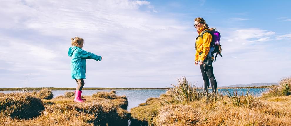
This webinar will help empower kids, and their parents and educators alike, to lead the way through engaging strategies when on the trail.
Presented by:
** This event has passed **
April 23, 2020
10:00 AM to 11:00 AM (Pacific Time) {more time zones}
Cost (RECORDING):
FREE for membersNote:
Closed Captioning is available for this webinar.
Learning Credits are available for this webinar.
This webinar is free. Would you consider a donation to support this webinar?
The California Trails and Greenways webinar series is offered in coordination with California State Parks and the California Trails Conference Foundation, with content selected from the California Trails and Greenways 2020 program.
The webinar series is offered FREE to the trails community THANKS TO the generous support of:
About this webinar:
A former award-winning science educator, Wendy Gorton is keen on helping families and programs understand how kids think and what motivates them outside. She is the author of the National Outdoor Book Award-winning series, 50 Hikes with Kids. The book empowers kids to lead the way through engaging strategies for each hike. This hands-on interactive webinar will also run through 7 innovative and different activities you can do with kids on the trail using technology, including: prioritizing, favoriting, researching, and contributing to the community hikes using AllTrails; identifying flora and fauna using iNaturalist and Seek from; identifying peaks around you using PeakVisor; geocaching by finding small treasures hidden with permission on public lands; learning mapping and orienteering skills with Google Maps, Compass, and Mapping apps such as Strava and GPS Tracker; and connecting with your visitors using social media accounts. Wendy also addresses the need for balance with technology and social-emotional wellness. For agencies who interact with children, this session will provide hands-on practice with ways to engage their visitors using technology. Attendees should leave with direct knowledge of each app, strategies to use, and possible events or activities to run at their site. This will result in more engagement on their trails, and also more documentation and connection to their visitors by connecting with them on social media. We will spend the final 5 minutes doing a protocol around integrating technology and engaging activities for kids on trails into attendees’ own programming. We'll have door prizes including copies of Wendy's hiking guide for kids.
Susan Lewwnz asks: What age are your books targeted for? 5-15 is good, but it’s fun to even look at the map with a 3 and 4 year-old or ask your 16 year-old to help lead with your younger sibling!
Eric Geels asks: When was the New England 50 Hikes scheduled to be released? Winter 2020!
Michelle O’Connor asks: Do you recommend less than 500 feet elevation gain or 1000 feet? Sure thing, I think kiddo’s can definitely do less but I encourage families to start challenging themselves!
Zachary Stevens asks: Do you have any stats on what families are looking for on hikes; time, length etc. Typically they want something interesting at the end, and between 1 and 2 miles and relatively flat. But I encourage families to start pushing themselves to further for greater rewards!
Jamie Bertram asks: Who is responsible for marking a trail closed? Is it done by the community that uses the website? That’s a great question! AllTrail’s community manager is really great and would be happy to answer if you want to shoot her an email - Meaghan Praznik [email protected] I think they must scan and update based on reviews or when notices go out.
Susan Hanson asks: Is there a way to use these techniques in a group setting? Absolutely! Encourage sharing the device, huddling around, or even have them use their own devices!
Beverly Gingg asks: Any school nature trail managers out there? Experiences using tech to help kids develop their own field guide to their nature trail?
Are there hikes geared toward exploring and learning about a specific ecosystem? Our book includes all ecosystems but we arrange it geographically, i.e. desert and Redwoods in California.
Leo Gustafson asks: How can I get google map to edit the boundary of the Refuge? It is consistently incorrect.On maps.google.com, Google your refuge and look for this button. Explain your change in the text field.
Sarah Chmielewski asks: How do you balance that with group hikes with their parents when they want to get lots of photos of the kid hiking? Great question -
Ashley Lord asks: Do you have any ideas for Girl Scout projects while at home? Yes! Scavenger Hunt badge - build a scavenger hunt and give it to a sibling to find on a neighborhood walk. Take a neighborhood walk and ID using Seek by iNaturalist one plant to get your Botanist Badge.
Subhashini Gamagedara asks: If you know resources on how geo caching is treated from a legal/ liability/policy standpoint from municipalities or Parks Departments that own the trails please let me know!
Yes, I believe each park makes their own policies on them, and they often require the geocache place to get written permission. [email protected] is really responsive if you want to ask!
The presenter asked the attendees: What kind of technology do you like to use on the Trail?
Avnza Maps is what we tend to use for an app for trails.
Merlin, ebird, plantnet
Cameras, ID apps like seek and merlin bird ID
"GAIA GPS”
Wildlife trail cameras
Plantsnap ID app, iNaturalist
Geocaching! GPS units are great!
Plant scanning apps to help with identification
Ebird
Our North Country Trail maps are available on Avenza Maps, an app.
Geocaching
Seek by INaturalist
Avenza map. Kids like Pokémon Go
Picture This Plant Identifier
GPS units/GNSS receivers’ w/cell phones
Guthook app
Agents of Discovery
Compass apps
Star gazing apps
GPS gear, Cameras, Strava
Ebird app
LA County Trails App
iNaturalist or SEEK used on programs
The Neon to Nature app was built in cooperation with the Southern Nevada Health and the local, regional and federal agencies in southern Nevada. It includes photos and trail information.
kidsinparks.com has a network of kid friendly trails across the country (12 states and counting) with an interactive map, info on the trails, and fun educational activities available at the trail on the website (and prizes for registering hikes)
mapmyrun
Avanza Maps
Alltrails, Hiking Upward
We only have a page for our state, but for local programs at schools, we encourage groups/pages based on whether is part of the planning process, education program etc.
Hoping to start an app on our trails for nature learning: plants, animals, endangered species, etc.
PictureThis - for plant identification

Wendy Gorton, Author, 50 Hikes with Kids Series
Portland, Oregon

Wendy Gorton holds a master’s degree in learning technologies and is a former classroom teacher. She is the author of the award-winning 50 Hikes with Kids series and has worked as a National Geographic Fellow in Australia researching Tasmanian devils, a PolarTREC teacher researcher in archaeology in Alaska, an Earthwatch teacher fellow in the Bahamas and New Orleans, and a GoNorth! teacher explorer studying climate change via dogsled in Finland, Norway, and Sweden. Today, she is a global education consultant who has traveled to more than fifty countries to design programs, build communities, and train other educators to do the same.
Visit her online at https://www.wendygorton.com
We are offering closed captioning for our webinars, thanks to a partnership with VZP Digital. If you are in need of this service, please email us prior to the webinar. An unedited transcript will be sent to all attendees following the webinar.
American Trails is proud to be a certified provider of the following learning credits and continuing education opportunities:
Learning credits are free for attendees for American Trails webinars and the International Trails Symposium, as well as for other conferences, webinars, and workshops we offer credits for. Learn more here.
While we may individually agree (or disagree) in whole or in part with any or all of the participants, the views expressed in these webinars are not necessarily representative of the views of American Trails as an organization or its board and staff. Unless specific situations are noted by presenters, nothing in American Trails webinars should be considered to be interpreted as a standard.
By registering for our webinars, you submit your information to the webinar organizer and associated presenters and sponsors, who may use it to communicate with you regarding this event and their other services. Your organization may also be added to the American Trails Business Directory. You can easily cancel your registration at any time.
2,900 views • posted 04/14/2020